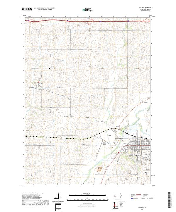
2022 Map of Atlantic
USGS Topo · Published 2022About this map
The Atlantic settlement and its surrounds in Cass County are defined by the convergence of agricultural transport routes and the meandering path of the East Nishnabotna River. This modern survey illustrates the civic heart of the area at the Cass County Courthouse, while the rural landscape to the west is divided into a systematic grid by roads such as Chicago Rd and Dallas Rd. The town of Marne sits at a critical junction of local thoroughfares and rail history, serving as a secondary hub to the larger county seat. Waterways like Troublesome Creek and Buck Cr carve through the section lines, shaping the placement of long-standing landmarks like Brighton Cem. The transition from historic wagon roads to modern infrastructure is evident in the presence of the Atlantic Municipal Airport and the recreational T-Bone Trl.
Find a feature on this map
54 named features on this map. Tap any name to fly to it.
Don’t see what you’re looking for? This feature index may not catch every label — zoom into the map to look around manually.
Map Details
Editions of this 2022 Atlantic Map
This is the sole edition of this map. No revisions or reprints were ever made.
Other maps of this area

1954 · Omaha
USGS Topo · 1:250,000

1957 · Omaha
USGS Topo · 1:250,000

1957 · Audubon
USGS Topo · 1:62,500

1958 · Omaha
USGS Topo · 1:250,000

1971 · Walnut
USGS Topo · 1:24,000

1971 · Wiota
USGS Topo · 1:24,000

1971 · Atlantic
USGS Topo · 1:24,000

1971 · Atlantic SW
USGS Topo · 1:24,000

1971 · Anita SW
USGS Topo · 1:24,000

1971 · Lewis
USGS Topo · 1:24,000