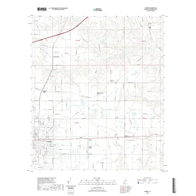
2018 Map of Atmore
USGS Topo · Published 2018About this map
The city of Atmore serves as the focal point of this Escambia County survey, showing the community's layout and its connection to surrounding agricultural hamlets. The landscape is dotted with small settlements like Martinville, Malta, and Canoe, connected by a grid of rural routes such as Robinsonville Rd and Martinville Loop. Genealogists will find a high concentration of burial grounds, including the historic Oak Hill Cem and Lucy Hill Cem in the western reaches, and the Robinsonville Church Cem to the north.
Find a feature on this map
139 named features on this map. Tap any name to fly to it.
Don’t see what you’re looking for? This feature index may not catch every label — zoom into the map to look around manually.
Map Details
Editions of this 2018 Atmore Map
This is the sole edition of this map. No revisions or reprints were ever made.
Other maps of this area

1941 · Century
USGS Topo · 1:62,500

1942 · Perdido
USGS Topo · 1:62,500

1942 · Dyas
USGS Topo · 1:62,500

1943 · Century
USGS Topo · 1:62,500

1944 · Dyas
USGS Topo · 1:62,500

1944 · Perdido
USGS Topo · 1:62,500

1953 · Andalusia
USGS Topo · 1:250,000

1957 · Andalusia
USGS Topo · 1:250,000

1957 · Pensacola
USGS Topo · 1:250,000

1959 · Pensacola
USGS Topo · 1:250,000