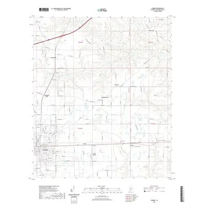
2020 Map of Atmore
USGS Topo · Published 2020About this map
Atmore serves as the primary hub in this southern Alabama landscape, where the street grid is surrounded by smaller satellite communities like Malta, Canoe, and Robinsonville. The terrain is defined by a dense network of intermittent and perennial waterways, including Sizemore Creek, Pine Barren Creek, and Canoe Creek, which drain the low-lying agricultural and forested lands. Genealogists will find a high concentration of burial sites throughout the quadrangle, such as Oak Hill Cemetery and Lucy Hill Cemetery near the town center, and more remote locations like Robinsonville Church Cemetery and Little Rock Church Cemetery. The infrastructure reflects a blend of local transit and aviation, anchored by the Atmore Municipal Airport and the historic settlement patterns along roads like Old Uriah Road and the Racetrack Road.
Find a feature on this map
140 named features on this map. Tap any name to fly to it.
Don’t see what you’re looking for? This feature index may not catch every label — zoom into the map to look around manually.
Map Details
Editions of this 2020 Atmore Map
This is the sole edition of this map. No revisions or reprints were ever made.
Other maps of this area

1941 · Century
USGS Topo · 1:62,500

1942 · Perdido
USGS Topo · 1:62,500

1942 · Dyas
USGS Topo · 1:62,500

1943 · Century
USGS Topo · 1:62,500

1944 · Dyas
USGS Topo · 1:62,500

1944 · Perdido
USGS Topo · 1:62,500

1953 · Andalusia
USGS Topo · 1:250,000

1957 · Andalusia
USGS Topo · 1:250,000

1957 · Pensacola
USGS Topo · 1:250,000

1959 · Pensacola
USGS Topo · 1:250,000