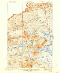
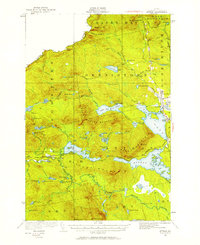
1925 Map of Attean
USGS Topo · Published 1944About this map
Jackman and the surrounding Somerset County wilderness are defined by the winding Moose River and the critical corridor of the Canadian Pacific railroad during the early 1920s. This survey reveals a landscape where commerce and topography are tightly linked, centered on the Jackman Station and local outposts like Boston Ranch and Holeb. The map provides a look at the infrastructure of the era, from the remote Stetson School to the Fire Station on Sally Mountain, highlighting the area's transition between managed timberlands and early transportation hubs.
Find a feature on this map
84 named features on this map. Tap any name to fly to it.
Don’t see what you’re looking for? This feature index may not catch every label — zoom into the map to look around manually.
Map Details
Editions of this 1925 Attean Map
6 editions found
Other maps of this area

1922 · Long Pond
USGS Topo · 1:62,500

1923 · Attean
USGS Topo · 1:62,500

1924 · Long Pond
USGS Topo · 1:62,500

1925 · Pierce Pond
USGS Topo · 1:48,000

1925 · Attean
USGS Topo · 1:62,500

1927 · Sandy Bay
USGS Topo · 1:48,000

1927 · Pierce Pond
USGS Topo · 1:62,500

1928 · Chain Lakes
USGS Topo · 1:48,000

1928 · Skinner
USGS Topo · 1:48,000

1928 · Spencer
USGS Topo · 1:48,000