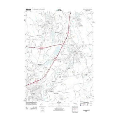
2012 Map of Attleboro
USGS Topo · Published 2012About this map
Industrial and residential development defines this section of the Massachusetts and Rhode Island border, centered on the high-density grid of Attleboro. The landscape is heavily influenced by the winding course of the Ten Mile River and the Bungay River, which feed a series of engineered water bodies including Manchester Pond and Orrs Pond. These waterways historically powered the region's jewelry and textile industries, leading to the establishment of surrounding villages like Dodgeville, Hebronville, and Attleboro Falls.
Find a feature on this map
344 named features on this map. Tap any name to fly to it.
Don’t see what you’re looking for? This feature index may not catch every label — zoom into the map to look around manually.
Map Details
Editions of this 2012 Attleboro Map
This is the sole edition of this map. No revisions or reprints were ever made.
Other maps of this area

1885 · Taunton
USGS Topo · 1:62,500

1886 · Dedham
USGS Topo · 1:62,500

1887 · Franklin
USGS Topo · 1:62,500

1887 · Providence
USGS Topo · 1:62,500

1888 · Taunton
USGS Topo · 1:62,500

1889 · Providence
USGS Topo · 1:62,500

1889 · Franklin
USGS Topo · 1:62,500

1893 · Taunton
USGS Topo · 1:62,500

1893 · Franklin
USGS Topo · 1:62,500

1894 · Dedham
USGS Topo · 1:62,500