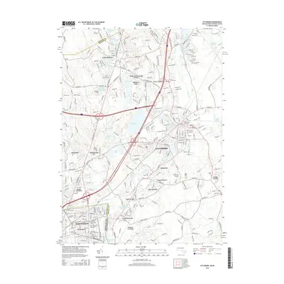
2015 Map of Attleboro
USGS Topo · Published 2015About this map
Ten Mile River serves as the hydrological spine for this industrial corridor, winding south through North Attleboro and Attleboro Falls before reaching the urban center of Attleboro. The map illustrates a landscape where early mill-pond developments have evolved into modern reservoirs and recreation areas, including Manchester Pond, Falls Pond, and the Ten Mile River Reservation. This 2015 update documents the dense suburban and industrial footprint surrounding the I-95 and I-295 interchange, showing how transit infrastructure has shaped the expansion of neighborhoods like South Attleboro and Dodgeville. Genealogists will find a high concentration of burial grounds, from the large Mount Hope Cem and Saint Marys Cem to the smaller Newell Cem and Hillside Cem. The boundary between Rhode Island and Massachusetts is clearly defined at the southern edge, where the urban grid of Pawtucket meets the outlying residential clusters of North Seekonk and Perrins Crossing.
Find a feature on this map
60 named features on this map. Tap any name to fly to it.
Don’t see what you’re looking for? This feature index may not catch every label — zoom into the map to look around manually.
Map Details
Editions of this 2015 Attleboro Map
This is the sole edition of this map. No revisions or reprints were ever made.
Other maps of this area

1885 · Taunton
USGS Topo · 1:62,500

1886 · Dedham
USGS Topo · 1:62,500

1887 · Franklin
USGS Topo · 1:62,500

1887 · Providence
USGS Topo · 1:62,500

1888 · Taunton
USGS Topo · 1:62,500

1889 · Providence
USGS Topo · 1:62,500

1889 · Franklin
USGS Topo · 1:62,500

1893 · Taunton
USGS Topo · 1:62,500

1893 · Franklin
USGS Topo · 1:62,500

1894 · Dedham
USGS Topo · 1:62,500