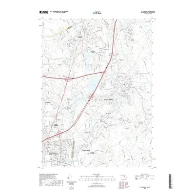
2018 Map of Attleboro
USGS Topo · Published 2018About this map
Attleboro and its surrounding mill-town satellites define this industrial corridor along the border of Massachusetts and Rhode Island. The course of the Ten Mile River and the Bungay River shaped the development of early manufacturing hubs like Dodgeville and Hebronville, where the proximity of water power once drove the local economy. To the south, the map captures the urban density of Pawtucket at Darlington, where the Pawtucket Industrial RR served the city's manufacturing districts. The landscape is a complex mix of historic residential neighborhoods, established cemeteries such as North Purchase Cem and Woodlawn Cem, and significant water bodies including Manchester Pond and the Hoppin Hill Reservoir. This modern survey also highlights protected areas like the Ten Mile River Reservation, illustrating how the region's natural river valleys have been preserved amidst centuries of urban growth.
Find a feature on this map
56 named features on this map. Tap any name to fly to it.
Don’t see what you’re looking for? This feature index may not catch every label — zoom into the map to look around manually.
Map Details
Editions of this 2018 Attleboro Map
This is the sole edition of this map. No revisions or reprints were ever made.
Other maps of this area

1885 · Taunton
USGS Topo · 1:62,500

1886 · Dedham
USGS Topo · 1:62,500

1887 · Franklin
USGS Topo · 1:62,500

1887 · Providence
USGS Topo · 1:62,500

1888 · Taunton
USGS Topo · 1:62,500

1889 · Providence
USGS Topo · 1:62,500

1889 · Franklin
USGS Topo · 1:62,500

1893 · Taunton
USGS Topo · 1:62,500

1893 · Franklin
USGS Topo · 1:62,500

1894 · Dedham
USGS Topo · 1:62,500