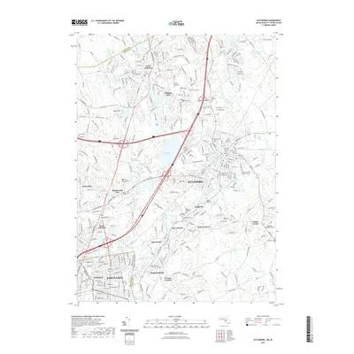
2021 Map of Attleboro
USGS Topo · Published 2021About this map
Attleboro and its industrial satellites anchor this 21st-century survey of the Massachusetts-Rhode Island borderlands. The landscape is defined by the winding course of the Ten Mile River, which connects a string of mill-era settlements including Attleboro Falls, Dodgeville, and Hebronville. While modern interstate infrastructure like I-95 and I-295 dominates the regional transit corridors, the map reveals a dense layer of local history through its numerous burial grounds. From the Old Kirk Yard Cem near the city center to the Solomon Family Burial Ground and the Briggsville Burial Ground further east, these sites provide essential touchstones for genealogical research. The northern reaches show a transition from the built-up environment of North Attleboro to the impounded waters of Whiting Pond and the Wading River Reservoir, illustrating the legacy of water management in this storied manufacturing corridor.
Find a feature on this map
58 named features on this map. Tap any name to fly to it.
Don’t see what you’re looking for? This feature index may not catch every label — zoom into the map to look around manually.
Map Details
Editions of this 2021 Attleboro Map
This is the sole edition of this map. No revisions or reprints were ever made.
Other maps of this area

1885 · Taunton
USGS Topo · 1:62,500

1886 · Dedham
USGS Topo · 1:62,500

1887 · Franklin
USGS Topo · 1:62,500

1887 · Providence
USGS Topo · 1:62,500

1888 · Taunton
USGS Topo · 1:62,500

1889 · Providence
USGS Topo · 1:62,500

1889 · Franklin
USGS Topo · 1:62,500

1893 · Taunton
USGS Topo · 1:62,500

1893 · Franklin
USGS Topo · 1:62,500

1894 · Dedham
USGS Topo · 1:62,500