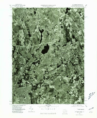
1977 Map of Attleboro
USGS Topo · Published 1981About this map
Ten Mile River winds southward through this 1970s orthophotoquad, serving as a geographic spine that connects the industrial and residential corridors of North Attleboro and Attleboro. Unlike a traditional line-drawn topographic map, this aerial perspective captures the dense suburban grain and commercial development of the late twentieth century, showing the precise footprint of neighborhoods and industrial sites as they appeared just before the 1980s. The transition from the northern population centers down through Hebronville toward the northern edge of Pawtucket reveals a landscape heavily shaped by its water-powered history, with the river valley functioning as a concentrated zone for infrastructure and habitation. This imagery is particularly valuable for researchers documenting the evolution of land use and building footprints in this corner of the Commonwealth.
Find a feature on this map
5 named features on this map. Tap any name to fly to it.
Don’t see what you’re looking for? This feature index may not catch every label — zoom into the map to look around manually.
Map Details
Editions of this 1977 Attleboro Map
This is the sole edition of this map. No revisions or reprints were ever made.
Other maps of this area

1885 · Taunton
USGS Topo · 1:62,500

1886 · Dedham
USGS Topo · 1:62,500

1887 · Franklin
USGS Topo · 1:62,500

1887 · Providence
USGS Topo · 1:62,500

1888 · Taunton
USGS Topo · 1:62,500

1889 · Providence
USGS Topo · 1:62,500

1889 · Franklin
USGS Topo · 1:62,500

1893 · Taunton
USGS Topo · 1:62,500

1893 · Franklin
USGS Topo · 1:62,500

1894 · Dedham
USGS Topo · 1:62,500