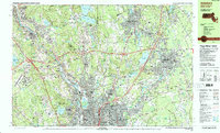
1987 Map of Attleboro
USGS Topo · Published 1987About this map
The Blackstone River corridor serves as the industrial and historical spine of this 1987 survey, connecting the urban centers of Pawtucket, Central Falls, and Woonsocket. This period captures the landscape as the traditional mill towns of Lonsdale, Ashton, and Albion sit alongside the modern expansion of Interstate 295 and Interstate 95. The map provides a detailed view of the borderlands between Rhode Island and Massachusetts, showing the transition from dense residential neighborhoods to large recreational and water management areas like Lincoln Woods State Park and the Diamond Hill Reservoir. Institutional landmarks, such as the Community College of Rhode Island and the Lincoln Greyhound Park, illustrate the region's mid-century development. Genealogists will find significant value in the clearly marked cemeteries, including Woodlawn Cem and North Purchase Cem, as well as numerous local schools and parish churches like St James Ch and Immanuel Ch.
Find a feature on this map
112 named features on this map. Tap any name to fly to it.
Don’t see what you’re looking for? This feature index may not catch every label — zoom into the map to look around manually.
Map Details
Editions of this 1987 Attleboro Map
2 editions found
Other maps of this area

1885 · Taunton
USGS Topo · 1:62,500

1886 · Blackstone
USGS Topo · 1:62,500

1886 · Dedham
USGS Topo · 1:62,500

1887 · Franklin
USGS Topo · 1:62,500

1887 · Providence
USGS Topo · 1:62,500

1888 · Taunton
USGS Topo · 1:62,500

1889 · Providence
USGS Topo · 1:62,500

1889 · Blackstone
USGS Topo · 1:62,500

1889 · Franklin
USGS Topo · 1:62,500

1889 · Burrillville
USGS Topo · 1:62,500