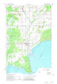
1966 Map of Au Gres
USGS Topo · Published 1978About this map
Saginaw Bay defines the southeastern edge of this Arenac County coastal region, where the Au Gres River meanders toward its mouth near the settlement of Au Gres. The landscape is a study in transition between the wooded wetlands of the Tittabawassee River State Forest and the agricultural grid of Turner and Whitney Townships. Small crossroads communities like Santiago and Delano appear as quiet rural anchors, supported by local landmarks such as Riverside Ch and Delano Ch.
Find a feature on this map
68 named features on this map. Tap any name to fly to it.
Don’t see what you’re looking for? This feature index may not catch every label — zoom into the map to look around manually.
Map Details
Editions of this 1966 Au Gres Map
2 editions found
Other maps of this area

1954 · Flint
USGS Topo · 1:250,000

1954 · Tawas City
USGS Topo · 1:250,000

1958 · Flint
USGS Topo · 1:250,000

1958 · Tawas City
USGS Topo · 1:250,000

1966 · Point Lookout
USGS Topo · 1:24,000

1966 · Au Gres
USGS Topo · 1:24,000

1966 · Alabaster
USGS Topo · 1:24,000

1966 · National City
USGS Topo · 1:24,000
1967 · Standish NE
USGS Topo · 1:24,000

1968 · Whittemore
USGS Topo · 1:24,000