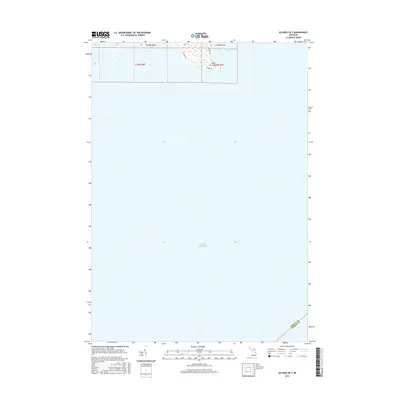
2017 Map of Au Gres OE S
USGS Topo · Published 2017About this map
Point au Gres stands as the primary terrestrial feature on this coastal survey, where the northern waters of Saginaw Bay meet the expanse of Lake Huron. The map depicts a predominantly aquatic landscape at the southeastern edge of Arenac County, illustrating the coastal interface and wetland areas surrounding the point. While much of the sheet is open water, the northern margin details the local road network that serves this shoreline community, including E Booth Rd, N Rumsey Rd, and S Point Ln. This 2017 data reflects the contemporary configuration of the shoreline and the boundary line between Arenac and Huron Counties deep within the bay.
Find a feature on this map
11 named features on this map. Tap any name to fly to it.
Don’t see what you’re looking for? This feature index may not catch every label — zoom into the map to look around manually.
Map Details
Editions of this 2017 Au Gres OE S Map
This is the sole edition of this map. No revisions or reprints were ever made.
Other maps of this area

1954 · Flint
USGS Topo · 1:250,000

1954 · Tawas City
USGS Topo · 1:250,000

1958 · Flint
USGS Topo · 1:250,000

1958 · Tawas City
USGS Topo · 1:250,000

1966 · Point Lookout
USGS Topo · 1:24,000

1966 · Au Gres
USGS Topo · 1:24,000
1967 · Standish NE
USGS Topo · 1:24,000
1968 · Omer
USGS Topo · 1:24,000

1984 · Tawas City
USGS Topo · 1:100,000
1984 · Bay City
USGS Topo · 1:100,000