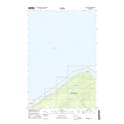
2017 Map of Au Sable Point
USGS Topo · Published 2017About this map
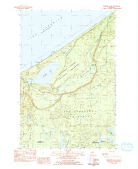
Au Sable Point projects into the cold waters of Lake Superior, serving as a focal point for this section of the Pictured Rocks National Lakeshore. The terrain is characterized by the immediate shoreline and the drainage patterns of Hurricane River and Sullivan Cr, which feeds into Sullivan Lake. Modern recreation and conservation are evident in the path of the N Country National Scenic Trail as it skirts the coast, providing access to this stretch of Alger County. The map details a network of forestry and local access roads such as H-58 Seasonal Rd and Timber Rd, reflecting the managed nature of the surrounding wilderness. This 2017 survey documents the precise boundary of the national lakeshore and the topographic contours of the coastal headlands during a period of established federal protection.
Find a feature on this map
13 named features on this map. Tap any name to fly to it.
Don’t see what you’re looking for? This feature index may not catch every label — zoom into the map to look around manually.
Map Details
Editions of this 2017 Au Sable Point Map
This is the sole edition of this map. No revisions or reprints were ever made.
Other maps of this area

1958 · Grand Portal Point
USGS Topo · 1:62,500

1958 · Marquette
USGS Topo · 1:250,000

1960 · Marquette
USGS Topo · 1:250,000

1961 · Marquette
USGS Topo · 1:250,000

1966 · Au Sable Point SE
USGS Topo · 1:24,000
1966 · Grand Sable Lake
USGS Topo · 1:24,000
1966 · Au Sable Point
USGS Topo · 1:24,000
1966 · Au Sable Point SW
USGS Topo · 1:24,000

1968 · Marquette
USGS Topo · 1:250,000
1983 · Trappers Lake
USGS Topo · 1:24,000