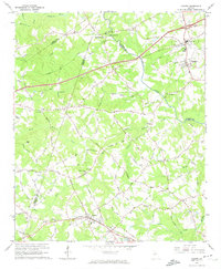
1964 Map of Auburn
USGS Topo · Published 1974About this map
The Mulberry River winds through the rolling landscape of the Piedmont, serving as a natural boundary between several counties. In the mid-1960s, this region was defined by its transition from a mill-based river economy to a landscape punctuated by small crossroads settlements and developing town centers. A historic Covered Bridge stands near Thompsons Mill, highlighting the area's early industrial and transportation roots along the river's edge.
Find a feature on this map
73 named features on this map. Tap any name to fly to it.
Don’t see what you’re looking for? This feature index may not catch every label — zoom into the map to look around manually.
Map Details
Editions of this 1964 Auburn Map
3 editions found
Other maps of this area

1891 · Gainesville
USGS Topo · 1:125,000

1896 · Monroe
USGS Topo · 1:125,000

1953 · Athens
USGS Topo · 1:250,000

1954 · Greenville
USGS Topo · 1:250,000

1958 · Greenville
USGS Topo · 1:250,000

1958 · Athens
USGS Topo · 1:250,000

1959 · Athens
USGS Topo · 1:250,000

1963 · Athens
USGS Topo · 1:250,000

1964 · Hog Mountain
USGS Topo · 1:24,000

1964 · Chestnut Mountain
USGS Topo · 1:24,000