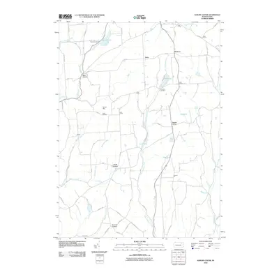
2010 Map of Auburn Center
USGS Topo · Published 2010About this map
Auburn Center and its surrounding rural hamlets define this 2010 landscape in Susquehanna County, where a complex network of waterways like Little Meshoppen Creek and Tuscarora Creek shapes the local geography. The map captures a region characterized by small crossroad settlements, including West Auburn, South Auburn, and Rushboro, many of which originated around historical road junctions. Genealogy researchers will find interest in Boles Cemetery near the center of the sheet, while prominent terrain features like Round Top and Shannon Hill provide context for the area's topographic character. The northern reaches are marked by significant water features such as Tuscarora Lake and the Tuscarora Lake Dam, highlighting the importance of water management and recreation in this part of Pennsylvania. Numerous ponds and small creeks, such as Lott Pond and Benninger Creek, are meticulously documented alongside a system of township and state roads.
Find a feature on this map
98 named features on this map. Tap any name to fly to it.
Don’t see what you’re looking for? This feature index may not catch every label — zoom into the map to look around manually.
Map Details
Editions of this 2010 Auburn Center Map
This is the sole edition of this map. No revisions or reprints were ever made.
Other maps of this area

1943 · Montrose
USGS Topo · 1:62,500

1943 · Le Raysville
USGS Topo · 1:62,500

1945 · Montrose
USGS Topo · 1:62,500

1945 · Le Raysville
USGS Topo · 1:62,500

1945 · Meshoppen
USGS Topo · 1:62,500

1945 · Auburn Center
USGS Topo · 1:24,000

1945 · Jenningsville
USGS Topo · 1:24,000

1945 · Meshoppen
USGS Topo · 1:24,000

1945 · Laceyville
USGS Topo · 1:24,000

1946 · Tunkhannock
USGS Topo · 1:62,500