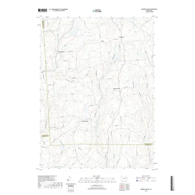
2019 Map of Auburn Center
USGS Topo · Published 2019About this map
Auburn Center and its surrounding hamlets occupy a landscape of complex drainage and distinct ridges in this 2019 survey of Susquehanna County. The settlement pattern is defined by upland plateaus and narrow creek valleys, with West Auburn, South Auburn, Retta, and Rushboro serving as local hubs connected by a network of state routes and township roads. Water features are abundant, ranging from the sizeable Tuscarora Lake in the north to numerous smaller bodies like Crescent Lake, Nick Pond, and Lott Pond. Genealogists and local historians will find value in the location of the Bolles Cem near Round Top, as well as the naming of family-related landmarks such as Coburn Hill and Robert Swamp. The map also captures the tri-county junction where Susquehanna, Bradford, and Wyoming counties meet, highlighting how the terrain influenced administrative boundaries.
Find a feature on this map
68 named features on this map. Tap any name to fly to it.
Don’t see what you’re looking for? This feature index may not catch every label — zoom into the map to look around manually.
Map Details
Editions of this 2019 Auburn Center Map
This is the sole edition of this map. No revisions or reprints were ever made.
Other maps of this area

1943 · Montrose
USGS Topo · 1:62,500

1943 · Le Raysville
USGS Topo · 1:62,500

1945 · Montrose
USGS Topo · 1:62,500

1945 · Le Raysville
USGS Topo · 1:62,500

1945 · Meshoppen
USGS Topo · 1:62,500

1945 · Auburn Center
USGS Topo · 1:24,000

1945 · Jenningsville
USGS Topo · 1:24,000

1945 · Meshoppen
USGS Topo · 1:24,000

1945 · Laceyville
USGS Topo · 1:24,000

1946 · Tunkhannock
USGS Topo · 1:62,500