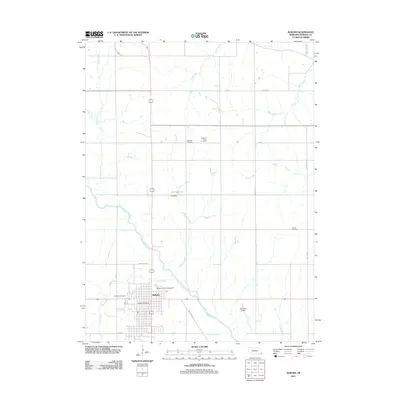
2011 Map of Auburn
USGS Topo · Published 2011About this map
Auburn serves as the central hub of this Nemaha County landscape, where the Little Nemaha River and its numerous tributaries like Willow Creek and Longs Creek carve through the agricultural terrain. The town's civic infrastructure is well-defined, featuring the Nemaha County Fairgrounds, the Auburn Post Office, and Farington Field. Water management is prominent in the northern reaches of the quadrangle, anchored by Ely Reservoir and the Ely Dam. For genealogists and local historians, the distribution of several burial grounds, including Highland Cemetery, Highland Ridge Cemetery, London Cemetery, and Sheridan Cemetery, provides a clear spatial record of the community's established families. The survey also captures the transition from town streets to rural routes such as Hale Breed Rd and Bethel Rd, illustrating the intersection of residential growth and Nebraska's deep-rooted farming heritage.
Find a feature on this map
27 named features on this map. Tap any name to fly to it.
Don’t see what you’re looking for? This feature index may not catch every label — zoom into the map to look around manually.
Map Details
Editions of this 2011 Auburn Map
This is the sole edition of this map. No revisions or reprints were ever made.
Other maps of this area

1907 · Nebraska City
USGS Topo · 1:62,500

1915 · Nemaha
USGS Topo · 1:62,500

1915 · Howe
USGS Topo · 1:62,500

1939 · Hamburg
USGS Topo · 1:62,500

1939 · Nemaha
USGS Topo · 1:62,500

1941 · Hamburg
USGS Topo · 1:62,500

1949 · Nemaha
USGS Topo · 1:62,500

1955 · Nebraska City
USGS Topo · 1:250,000

1957 · Nebraska City
USGS Topo · 1:250,000

1958 · Nebraska City
USGS Topo · 1:250,000
Featured Places
- Auburn, NE
- Terrace Mobile Home Park, Auburn
- Southside Trailer Park, Auburn
- Nemaha County, NE
- United States