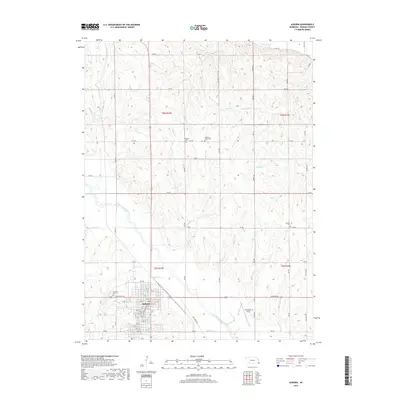
2017 Map of Auburn
USGS Topo · Published 2017About this map
Auburn serves as the primary hub of this eastern Nebraska landscape, situated near the confluence of Longs Cr and the Little Nemaha River. The town's grid is well-established, centered on Central Ave and stretching from 6th St down to 28 St. The surrounding countryside is defined by a dense network of watercourses, including Rock Cr, Buck Cr, and Willow Cr, which carve through the terrain between rural sections.
Find a feature on this map
52 named features on this map. Tap any name to fly to it.
Don’t see what you’re looking for? This feature index may not catch every label — zoom into the map to look around manually.
Map Details
Editions of this 2017 Auburn Map
This is the sole edition of this map. No revisions or reprints were ever made.
Other maps of this area

1907 · Nebraska City
USGS Topo · 1:62,500

1915 · Nemaha
USGS Topo · 1:62,500

1915 · Howe
USGS Topo · 1:62,500

1939 · Hamburg
USGS Topo · 1:62,500

1939 · Nemaha
USGS Topo · 1:62,500

1941 · Hamburg
USGS Topo · 1:62,500

1949 · Nemaha
USGS Topo · 1:62,500

1955 · Nebraska City
USGS Topo · 1:250,000

1957 · Nebraska City
USGS Topo · 1:250,000

1958 · Nebraska City
USGS Topo · 1:250,000
Featured Places
- Auburn, NE
- Terrace Mobile Home Park, Auburn
- Southside Trailer Park, Auburn
- Nemaha County, NE
- United States