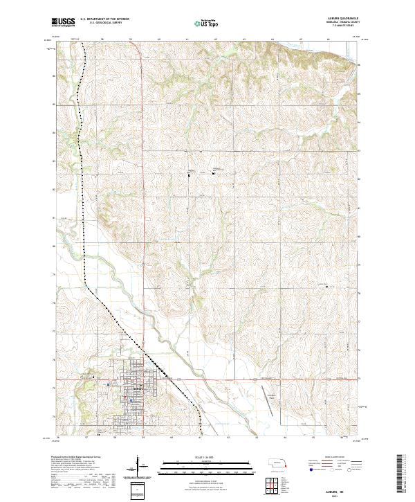
2021 Map of Auburn
USGS Topo · Published 2021About this map
The Nemaha County Courthouse serves as the focal point for Auburn, where a systematic grid of streets including Central Ave and 22nd St defines the city's residential and commercial core. This 2021 survey illustrates the city’s expansion south of the Little Nemaha River, which meanders across the landscape toward its junctions with smaller tributaries like Longs Cr and Codington Cr. The surrounding countryside is characterized by a dense network of sectional roads and family-linked sites, including numerous burial grounds like Sheridan Cem and Saint Pauls Cem.
Find a feature on this map
55 named features on this map. Tap any name to fly to it.
Don’t see what you’re looking for? This feature index may not catch every label — zoom into the map to look around manually.
Map Details
Editions of this 2021 Auburn Map
This is the sole edition of this map. No revisions or reprints were ever made.
Other maps of this area

1907 · Nebraska City
USGS Topo · 1:62,500

1915 · Nemaha
USGS Topo · 1:62,500

1915 · Howe
USGS Topo · 1:62,500

1939 · Hamburg
USGS Topo · 1:62,500

1939 · Nemaha
USGS Topo · 1:62,500

1941 · Hamburg
USGS Topo · 1:62,500

1949 · Nemaha
USGS Topo · 1:62,500

1955 · Nebraska City
USGS Topo · 1:250,000

1957 · Nebraska City
USGS Topo · 1:250,000

1958 · Nebraska City
USGS Topo · 1:250,000
Featured Places
- Auburn, NE
- Southside Trailer Park, Auburn
- Terrace Mobile Home Park, Auburn
- Nemaha County, NE
- United States