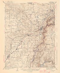
1944 Map of Auburn
USGS Topo · Published 1944About this map
Auburn serves as the focal point of this Placer County survey, situated at the confluence of several vital transportation corridors during the early 1940s. The Southern Pacific railroad and the Pacific Highway parallel one another as they climb the foothills, linking the agricultural settlements of Rocklin, Loomis, Penryn, and Newcastle. The map reveals a high density of rural schoolhouses, such as the Japanese Sch and the Union Grammar Sch, indicating a well-established social fabric in the fruit-growing districts surrounding Ophir and Gold Hill.
Find a feature on this map
78 named features on this map. Tap any name to fly to it.
Don’t see what you’re looking for? This feature index may not catch every label — zoom into the map to look around manually.
Map Details
Editions of this 1944 Auburn Map
3 editions found
Other maps of this area

1888 · Smartsville
USGS Topo · 1:125,000

1891 · Sacramento
USGS Topo · 1:125,000

1891 · Colfax
USGS Topo · 1:125,000

1891 · Smartsville
USGS Topo · 1:125,000

1891 · Placerville
USGS Topo · 1:125,000

1892 · Sacramento
USGS Topo · 1:125,000

1892 · Placerville
USGS Topo · 1:125,000

1892 · Smartsville
USGS Topo · 1:125,000

1892 · Colfax
USGS Topo · 1:125,000

1893 · Placerville
USGS Topo · 1:125,000