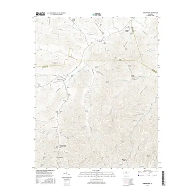
2016 Map of Auburntown
USGS Topo · Published 2016About this map
Auburntown serves as the primary hub in this central Tennessee landscape, where the borders of Cannon, Wilson, and DeKalb counties converge. The terrain is defined by a dense network of hollows and ridges, including Pleasant Ridge and the prominent Fodderstack Knob. Small, historic settlements like Prosperity, Cottage Home, and Hardscrabble are scattered throughout the hills, connected by winding routes such as Old State Hwy 96. Many of these locations are linked to specific family lineages, evidenced by the high density of small family burial grounds like Milligan Alexander Cem, Alexander Hollow Duggin Cem, and Davenport Cem. Waterways including Saunders Fork and Hurricane Cr cut through the hollows, illustrating a long-established rural settlement pattern where homes and cemeteries were placed on higher ground above the stream beds.
Find a feature on this map
115 named features on this map. Tap any name to fly to it.
Don’t see what you’re looking for? This feature index may not catch every label — zoom into the map to look around manually.
Map Details
Editions of this 2016 Auburntown Map
This is the sole edition of this map. No revisions or reprints were ever made.
Other maps of this area

1893 · Mc Minnville
USGS Topo · 1:125,000

1895 · Mc Minnville
USGS Topo · 1:125,000

1908 · Woodbury
USGS Topo · 1:62,500

1928 · Gordonsville
USGS Topo · 1:62,500

1942 · Statesville
USGS Topo · 1:100,000

1953 · Chattanooga
USGS Topo · 1:250,000

1956 · Columbia
USGS Topo · 1:250,000

1956 · Corbin
USGS Topo · 1:250,000

1956 · Nashville
USGS Topo · 1:250,000

1957 · Chattanooga
USGS Topo · 1:250,000