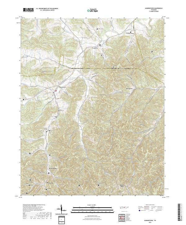
2022 Map of Auburntown
USGS Topo · Published 2022About this map
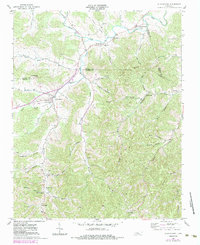
Auburntown and the surrounding Cannon County landscape are defined by a complex network of valleys and hollows carved by Saunders Fork and its many tributaries. This 2022 survey captures a rural Tennessee environment where small communities like Prosperity, Cottage Home, and Brysonville are connected by winding country roads that follow the natural topography. The map reveals an exceptionally dense distribution of family and community burial grounds, including the Milligan Alexander Cem, Brandon Cem, and Kennedy Cem, suggesting a long-standing pattern of generational settlement. Distinctive terrain features such as Fodderstack Knob and Hawkins Hill rise above the many named depressions like Talent Hollow and Shirley Hollow. The intersection of multiple county lines, including the borders of Wilson and DeKalb, further marks this area as a traditional crossroads of Middle Tennessee agricultural life.
Find a feature on this map
119 named features on this map. Tap any name to fly to it.
Don’t see what you’re looking for? This feature index may not catch every label — zoom into the map to look around manually.
Map Details
Editions of this 2022 Auburntown Map
This is the sole edition of this map. No revisions or reprints were ever made.