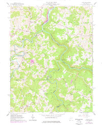
1960 Map of Audra
USGS Topo · Published 1978About this map
Audra State Park forms the heart of this landscape, where the Middle Fork River joins the Tygart Valley River in a rugged display of West Virginia's Appalachian terrain. The region's industrial and social life is etched into the hills through the winding tracks of the Baltimore and Ohio railroad, which services junctions at Tygart Junction and Century Junction. Rural settlements like Carrollton and Boulder reveal the era's reliance on small-scale community centers, marked by name-specific landmarks such as Mt Olivet Ch and the Rock Springs Sch. The 1970s revisions, shown in purple, highlight a shift toward resource extraction with the appearance of Strip Mines in the Barker district, while older family lineages remain grounded in cemeteries like Bethany Cem and the Radabaugh Cem near Five Forks.
Find a feature on this map
67 named features on this map. Tap any name to fly to it.
Don’t see what you’re looking for? This feature index may not catch every label — zoom into the map to look around manually.
Map Details
Editions of this 1960 Audra Map
3 editions found
Other maps of this area

1886 · St. George
USGS Topo · 1:125,000

1889 · Beverly
USGS Topo · 1:125,000

1891 · St. George
USGS Topo · 1:125,000

1892 · Beverly
USGS Topo · 1:125,000

1893 · Buckhannon
USGS Topo · 1:125,000

1896 · Buckhannon
USGS Topo · 1:125,000

1897 · Buckhannon
USGS Topo · 1:125,000

1904 · Philippi
USGS Topo · 1:62,500

1907 · Belington
USGS Topo · 1:62,500

1909 · Elkins
USGS Topo · 1:62,500