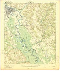
1921 Map of Augusta
USGS Topo · Published 1921About this map
The Savannah River defines the heart of this 1921 survey, winding through a complex of oxbows and backwaters that separate Richmond County, Georgia, from Aiken County, South Carolina. The city of Augusta dominates the northwest corner, serving as a hub for major rail lines including the Southern RR and Georgia RR. Beyond the urban grid, the landscape reveals a series of distinct riverine features like Horseshoe Lake, Island Lake, and the notable New Savannah Bluff, which speak to the area's long-standing relationship with the river's shifting path.
Find a feature on this map
81 named features on this map. Tap any name to fly to it.
Don’t see what you’re looking for? This feature index may not catch every label — zoom into the map to look around manually.
Map Details
Editions of this 1921 Augusta Map
5 editions found
Other maps of this area

1892 · Mc Cormick
USGS Topo · 1:125,000

1912 · Mc Cormick
USGS Topo · 1:125,000

1919 · Gough
USGS Topo · 1:62,500

1920 · Ellenton
USGS Topo · 1:48,000

1920 · Greens Cut
USGS Topo · 1:62,500

1920 · Aiken
USGS Topo · 1:48,000

1920 · Talatha
USGS Topo · 1:48,000

1920 · Clarks Hill
USGS Topo · 1:48,000

1921 · Augusta
USGS Topo · 1:62,500

1921 · Aiken
USGS Topo · 1:62,500