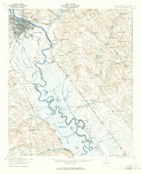
1921 Map of Augusta
USGS Topo · Published 1965About this map
The Savannah River dominates this landscape, serving as the border between Georgia and South Carolina just downstream from Augusta. The river's winding course creates a series of oxbows and cutoffs, such as Horseshoe Lake, Island Lake, and the complex Holmes Dead River. On the Georgia side, the expansive Phinizy Swamp and numerous creeks like Butler Creek define the low-lying terrain. To the east in South Carolina, the geography shifts toward higher ground, marked by features like Browns Hill and Mecham Hill.
Find a feature on this map
96 named features on this map. Tap any name to fly to it.
Don’t see what you’re looking for? This feature index may not catch every label — zoom into the map to look around manually.
Map Details
Editions of this 1921 Augusta Map
5 editions found
Other maps of this area

1892 · Mc Cormick
USGS Topo · 1:125,000

1912 · Mc Cormick
USGS Topo · 1:125,000

1919 · Gough
USGS Topo · 1:62,500

1920 · Ellenton
USGS Topo · 1:48,000

1920 · Greens Cut
USGS Topo · 1:62,500

1920 · Aiken
USGS Topo · 1:48,000

1920 · Talatha
USGS Topo · 1:48,000

1920 · Clarks Hill
USGS Topo · 1:48,000

1921 · Augusta
USGS Topo · 1:62,500

1921 · Aiken
USGS Topo · 1:62,500