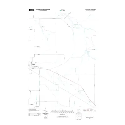
2013 Map of Augusta East
USGS Topo · Published 2013About this map
The city of Augusta serves as the focal point of this Eastern Eau Claire County landscape, where the residential street grid gives way to a network of rural roads and winding waterways. Us-12 and E Lincoln St provide the primary east-west corridors, crossing several tributaries that feed into the larger hydrologic system. The northern portion of the map is defined by the Eau Claire River and its varied drainage basins, including Whippoorwill Cr and the descriptively named Coon Gut Cr. Further east, the Coon Fork Cr leads into Coon Fork Lake 45, a significant water feature in this agricultural and forested terrain. The southern reaches are characterized by long, named valleys such as Diamond Valley Cr, illustrating how the local topography influenced the placement of homesteads and dairy roads like Oak Ridge Rd and Brunzil Rd.
Find a feature on this map
46 named features on this map. Tap any name to fly to it.
Don’t see what you’re looking for? This feature index may not catch every label — zoom into the map to look around manually.
Map Details
Editions of this 2013 Augusta East Map
This is the sole edition of this map. No revisions or reprints were ever made.
Other maps of this area

1935 · Osseo
USGS Topo · 1:48,000

1940 · Osseo
USGS Topo · 1:62,500

1948 · Fairchild
USGS Topo · 1:62,500

1949 · Fairchild
USGS Topo · 1:62,500

1952 · Cadott
USGS Topo · 1:62,500

1952 · Stanley
USGS Topo · 1:62,500

1953 · Eau Claire
USGS Topo · 1:250,000

1958 · Eau Claire
USGS Topo · 1:250,000

1964 · Eau Claire
USGS Topo · 1:250,000
1968 · Osseo
USGS Topo · 1:62,500