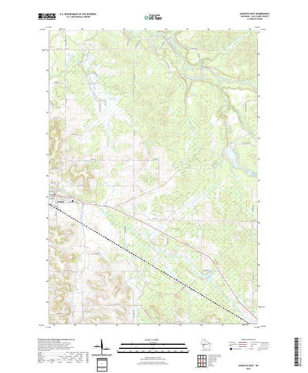
2022 Map of Augusta East
USGS Topo · Published 2022About this map
The city of Augusta occupies the western edge of this landscape, serving as a hub for the surrounding agricultural and forest lands of eastern Eau Claire County. Just outside the city limits, the East Lawn Cem provides a focal point for genealogical research. The terrain is defined by a dense network of waterways, including the winding Eau Claire River in the north and several significant tributaries like Bridge Cr and Coon Fork Cr. These streams create a complex drainage pattern across the township boundaries of T26N R6W and T25N R5W. Road names such as Hay Creek Rd and Brunzil Rd hint at the family names and local geography that have shaped the area's rural identity. The presence of Black Creek and Travers Cr in the southeastern quadrant illustrates the varied hydrography that continues to influence local land use.
Find a feature on this map
62 named features on this map. Tap any name to fly to it.
Don’t see what you’re looking for? This feature index may not catch every label — zoom into the map to look around manually.
Map Details
Editions of this 2022 Augusta East Map
This is the sole edition of this map. No revisions or reprints were ever made.
Other maps of this area

1935 · Osseo
USGS Topo · 1:48,000

1940 · Osseo
USGS Topo · 1:62,500

1948 · Fairchild
USGS Topo · 1:62,500

1949 · Fairchild
USGS Topo · 1:62,500

1952 · Cadott
USGS Topo · 1:62,500

1952 · Stanley
USGS Topo · 1:62,500

1953 · Eau Claire
USGS Topo · 1:250,000

1958 · Eau Claire
USGS Topo · 1:250,000

1964 · Eau Claire
USGS Topo · 1:250,000
1968 · Osseo
USGS Topo · 1:62,500