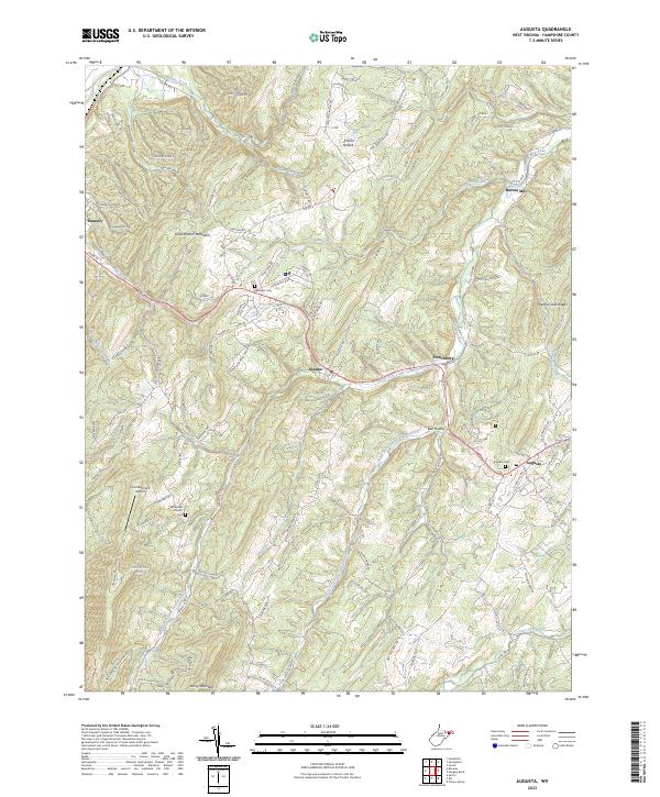
2023 Map of Augusta
USGS Topo · Published 2023About this map
Augusta and Shanks serve as central points in this Hampshire County landscape, where the North Fork Little Cacapon River and its sister forks carve deep valleys through the Appalachian ridges. The map documents a rural network of country roads like Co Rte 50/11 and family-named landmarks that speak to generations of local settlement. Genealogy interests are well-served by the presence of the Augusta Cem and Ebenezer Cem, alongside the historic Old Bethel Church near the base of Lost Mountain. To the south, the Nathaniel Mountain WMA preserves a significant portion of the high ground, while the Lost Mountain Airport and Everett Fruit Farm Spring indicate the intersection of local aviation and agriculture. The drainage pattern of Shawan Run and Buffalo Creek illustrates the complex topography between South Branch Mountain and Town Hill, defining the settlement patterns of Frenchburg and Barnes Mill.
Find a feature on this map
120 named features on this map. Tap any name to fly to it.
Don’t see what you’re looking for? This feature index may not catch every label — zoom into the map to look around manually.
Map Details
Editions of this 2023 Augusta Map
This is the sole edition of this map. No revisions or reprints were ever made.
Other maps of this area

1891 · Romney
USGS Topo · 1:125,000

1920 · Moorefield
USGS Topo · 1:62,500

1920 · Keyser
USGS Topo · 1:62,500

1921 · Keyser
USGS Topo · 1:48,000

1921 · Hanging Rock
USGS Topo · 1:48,000

1921 · Moorefield
USGS Topo · 1:48,000

1922 · Moorefield
USGS Topo · 1:62,500

1922 · Wardensville
USGS Topo · 1:62,500

1922 · Keyser
USGS Topo · 1:62,500

1923 · Hanging Rock
USGS Topo · 1:62,500