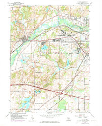
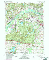
1961 Map of Augusta
USGS Topo · Published 1973About this map
The Kalamazoo River winds through this landscape, marking a vital corridor between Augusta and the industrial fringes of Battle Creek. During the early 1960s, this area was defined by a heavy military and institutional presence, centered on the sprawling grounds of Fort Custer State Park and the Custer Air Force Station. The map illustrates a complex transportation network where the Penn Central and Grand Trunk Western railroads parallel major thoroughfares like Dickman Road. Local life is anchored by residential clusters at Level Park and Oak Park, while several rural burying grounds, including Lawler Cem and Bedford Cem, offer valuable data for genealogists. The southern portion of the sheet reveals a distinct change in pace, transitioning to a dense cluster of water bodies like Portage Lake and Eagle Lake, highlighting the region's natural hydrography alongside significant landmarks such as the Veterans Administration Hospital.
Find a feature on this map
45 named features on this map. Tap any name to fly to it.
Don’t see what you’re looking for? This feature index may not catch every label — zoom into the map to look around manually.
Map Details
Editions of this 1961 Augusta Map
5 editions found
Other maps of this area

1918 · Battle Creek
USGS Topo · 1:62,500

1918 · Union City
USGS Topo · 1:62,500

1918 · Galesburg
USGS Topo · 1:62,500

1918 · Leonidas
USGS Topo · 1:62,500

1943 · Battle Creek
USGS Topo · 1:62,500

1944 · Leonidas
USGS Topo · 1:62,500

1944 · Galesburg
USGS Topo · 1:62,500

1947 · Augusta
USGS Topo · 1:24,000

1947 · Delton
USGS Topo · 1:24,000

1947 · Galesburg
USGS Topo · 1:24,000