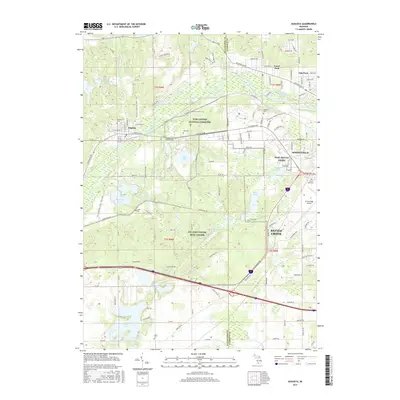
2017 Map of Augusta
USGS Topo · Published 2017About this map
The Kalamazoo River cuts through this portion of western Michigan, defining a landscape heavily shaped by military and aviation infrastructure during the late twenty-first century. This territory is dominated by the CTC Fort Custer Trng Center and the extensive grounds of the Fort Custer National Cemetery, which sit alongside the NOSC Battle Creek facility. To the west, the village of Augusta occupies a position where Augusta Cr meets the river, while the eastern edge of the map transitions into the industrial and residential outskirts of Battle Creek and Springfield. Numerous small lakes, including Eagle Lake, Whitford Lake, and Portage Lake, are scattered throughout the glacial terrain. This map provides a detailed view of the regional connectivity between W K Kellogg Airport and local neighborhoods like Level Park and Oak Park, revealing how public lands and defense installations have preserved significant open spaces between these growing urban centers.
Find a feature on this map
161 named features on this map. Tap any name to fly to it.
Don’t see what you’re looking for? This feature index may not catch every label — zoom into the map to look around manually.
Map Details
Editions of this 2017 Augusta Map
This is the sole edition of this map. No revisions or reprints were ever made.
Other maps of this area

1918 · Battle Creek
USGS Topo · 1:62,500

1918 · Union City
USGS Topo · 1:62,500

1918 · Galesburg
USGS Topo · 1:62,500

1918 · Leonidas
USGS Topo · 1:62,500

1943 · Battle Creek
USGS Topo · 1:62,500

1944 · Leonidas
USGS Topo · 1:62,500

1944 · Galesburg
USGS Topo · 1:62,500

1947 · Augusta
USGS Topo · 1:24,000

1947 · Delton
USGS Topo · 1:24,000

1947 · Galesburg
USGS Topo · 1:24,000