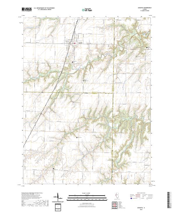
2024 Map of Augusta
USGS Topo · Published 2024About this map
Augusta serves as the primary hub of this west-central Illinois landscape, where the town’s grid is centered near the junction of Main St and Center St. The surrounding geography is defined by a series of deep drainage networks, including Williams Creek and Cedar Creek, which carve through the till plains of the Hancock, Adams, and Schuyler county borders. This modern topographic record reveals a persistent rural cemetery pattern essential for genealogical research, with numerous family and community burial grounds such as Hawkins Cem, Woodlawn Cem, and Leenerts Cem scattered across the township lines. The map also traces local thoroughfares like Nubbin Ridge Rd and Harrison Br Rd, illustrating how modern infrastructure follows the established contours of the land and its historic watercourses like South Branch Cedar Creek.
Find a feature on this map
84 named features on this map. Tap any name to fly to it.
Don’t see what you’re looking for? This feature index may not catch every label — zoom into the map to look around manually.
Map Details
Editions of this 2024 Augusta Map
This is the sole edition of this map. No revisions or reprints were ever made.
Other maps of this area

1913 · Colchester
USGS Topo · 1:62,500

1933 · Carthage
USGS Topo · 1:62,500

1937 · Carthage
USGS Topo · 1:62,500

1946 · Augusta
USGS Topo · 1:62,500

1948 · Camp Point
USGS Topo · 1:62,500

1949 · Augusta
USGS Topo · 1:62,500

1958 · Burlington
USGS Topo · 1:250,000

1961 · Burlington
USGS Topo · 1:250,000

1963 · Burlington
USGS Topo · 1:250,000
1974 · Bentley
USGS Topo · 1:24,000