
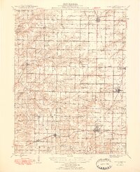
1948 Map of Camp Point
USGS Topo · Published 1948About this map
Camp Point and its neighboring agricultural townships sit at the heart of this post-war landscape, where the rural schoolhouse system remained remarkably intact. The map reveals a dense network of one-room schoolhouses like Blue Stocking Sch, Lone Star Sch, and Mission Ridge Sch spaced at regular intervals to serve the farming families of the Adams and Hancock borderlands. This late-1940s view captures the transition as these local districts began to consolidate, yet still honors the traditional township structure that defined Illinois life for generations.
Find a feature on this map
87 named features on this map. Tap any name to fly to it.
Don’t see what you’re looking for? This feature index may not catch every label — zoom into the map to look around manually.
Map Details
Editions of this 1948 Camp Point Map
2 editions found
Other maps of this area

1913 · Colchester
USGS Topo · 1:62,500

1925 · Quincy
USGS Topo · 1:62,500

1925 · Liberty
USGS Topo · 1:62,500

1926 · Mt Sterling
USGS Topo · 1:62,500

1927 · Liberty
USGS Topo · 1:62,500

1929 · Mt Sterling
USGS Topo · 1:62,500

1933 · Carthage
USGS Topo · 1:62,500

1936 · Keokuk
USGS Topo · 1:62,500

1937 · Carthage
USGS Topo · 1:62,500

1944 · Quincy
USGS Topo · 1:62,500