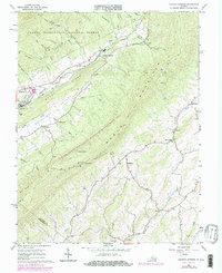
1967 Map of Augusta Springs
USGS Topo · Published 1978About this map
Augusta Springs and the surrounding valley are defined by the narrow corridor of the Chesapeake and Ohio railroad, which follows the winding path of the Little Calfpasture River. This late-1960s landscape, updated in the 1970s, preserves the industrial and spiritual footprints of the region. Evidence of the early iron industry is visible at the Estaline Furnace (Ruins) near Black Creek, while local genealogy is rooted in sites like Miller Memorial Ch, Shemariah Ch, and the Mt Herman Cem.
Find a feature on this map
43 named features on this map. Tap any name to fly to it.
Don’t see what you’re looking for? This feature index may not catch every label — zoom into the map to look around manually.
Map Details
Editions of this 1967 Augusta Springs Map
Other maps of this area

1894 · Staunton
USGS Topo · 1:125,000

1894 · Lexington
USGS Topo · 1:125,000

1932 · Lexington
USGS Topo · 1:48,000

1936 · Vesuvius
USGS Topo · 1:48,000

1937 · Lexington
USGS Topo · 1:62,500

1941 · Vesuvius
USGS Topo · 1:62,500

1943 · Craigsville
USGS Topo · 1:62,500

1944 · Staunton
USGS Topo · 1:62,500

1945 · Craigsville
USGS Topo · 1:62,500

1947 · Staunton
USGS Topo · 1:62,500