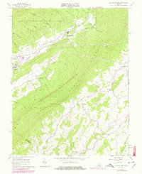
1967 Map of Augusta Springs
USGS Topo · Published 1978About this map
The Little Calfpasture River and the tracks of the Chesapeake and Ohio railroad corridor define the industrial and residential development of this Virginia landscape. During the late 1960s, the settlements of Augusta Springs, Craigsville, and Fordwick clustered along these vital transport lines, supported by local industry like the nearby Quarry. Historical remnants of the region's iron-making past are preserved in the Estaline Furnace (Ruins) located within the Estaline Valley. This survey captures the rural character of the Augusta and Rockbridge county line before the expansion of local infrastructure. Beyond the valley floor, the terrain rises sharply into the Little North Mountain range, much of which is protected as part of the George Washington National Forest. Scattered through the hollows are local landmarks of genealogical interest, including Miller Memorial Ch, Shemariah Ch, and the Mt Herman Cem near Newport.
Find a feature on this map
39 named features on this map. Tap any name to fly to it.
Don’t see what you’re looking for? This feature index may not catch every label — zoom into the map to look around manually.
Map Details
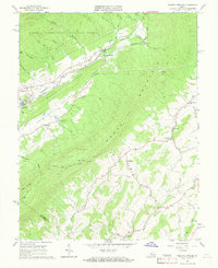
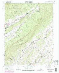
Editions of this 1967 Augusta Springs Map
Other maps of this area

1894 · Staunton
USGS Topo · 1:125,000

1894 · Lexington
USGS Topo · 1:125,000

1932 · Lexington
USGS Topo · 1:48,000

1936 · Vesuvius
USGS Topo · 1:48,000

1937 · Lexington
USGS Topo · 1:62,500

1941 · Vesuvius
USGS Topo · 1:62,500

1943 · Craigsville
USGS Topo · 1:62,500

1944 · Staunton
USGS Topo · 1:62,500

1945 · Craigsville
USGS Topo · 1:62,500

1947 · Staunton
USGS Topo · 1:62,500