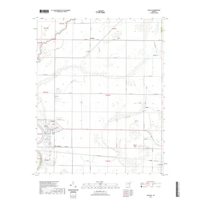
2020 Map of Augusta
USGS Topo · Published 2020About this map
The White River forms a natural western boundary for this portion of Woodruff County, where the city of Augusta serves as the local seat of government. Centered on the Woodruff County Courthouse, the town layout features a grid of streets including Magnolia, Spruce St, and Shell St near the riverbank. To the east and south, the landscape transitions into a network of agricultural lands and wetlands, evidenced by Cypress Brake and the winding course of Maple Creek.
Find a feature on this map
81 named features on this map. Tap any name to fly to it.
Don’t see what you’re looking for? This feature index may not catch every label — zoom into the map to look around manually.
Map Details
Editions of this 2020 Augusta Map
This is the sole edition of this map. No revisions or reprints were ever made.
Other maps of this area

1935 · Augusta
USGS Topo · 1:62,500

1935 · Gregory
USGS Topo · 1:62,500

1939 · Hunter
USGS Topo · 1:62,500

1940 · Tilton
USGS Topo · 1:62,500

1953 · Memphis
USGS Topo · 1:250,000

1956 · Memphis
USGS Topo · 1:250,000

1956 · Tilton
USGS Topo · 1:62,500

1956 · Hunter
USGS Topo · 1:62,500

1957 · Augusta
USGS Topo · 1:62,500

1957 · Gregory
USGS Topo · 1:62,500