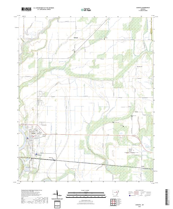
2024 Map of Augusta
USGS Topo · Published 2024About this map
The White River forms a natural western boundary for Augusta, the Woodruff County seat where the Woodruff County Courthouse stands at the center of a traditional grid. This riverine landscape is defined by its drainage patterns, with Taylor Bay and Cypress Brake marking low-lying areas north of the primary settlement. The transition from the town center to the surrounding agricultural prairie is punctuated by several small, dispersed communities including New Augusta, Fitzhugh, and Union.
Find a feature on this map
84 named features on this map. Tap any name to fly to it.
Don’t see what you’re looking for? This feature index may not catch every label — zoom into the map to look around manually.
Map Details
Editions of this 2024 Augusta Map
This is the sole edition of this map. No revisions or reprints were ever made.
Other maps of this area

1935 · Augusta
USGS Topo · 1:62,500

1935 · Gregory
USGS Topo · 1:62,500

1939 · Hunter
USGS Topo · 1:62,500

1940 · Tilton
USGS Topo · 1:62,500

1953 · Memphis
USGS Topo · 1:250,000

1956 · Memphis
USGS Topo · 1:250,000

1956 · Tilton
USGS Topo · 1:62,500

1956 · Hunter
USGS Topo · 1:62,500

1957 · Augusta
USGS Topo · 1:62,500

1957 · Gregory
USGS Topo · 1:62,500