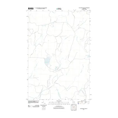
2010 Map of Augustine Lake
USGS Topo · Published 2010About this map
Augustine Lake and its smaller neighbor Cammerer Lake anchor this Northwoods landscape, where a dense network of forest roads and fire lanes facilitates access for timber management and outdoor recreation. The drainage patterns are defined by the East Fork Chippewa River, which winds through the southern reaches of the quadrangle. A system of namesake waterways, including Augustine Creek and Silver Creek, feeds into the larger river system, illustrating the intricate hydrology of the region. Local navigation is guided by numerous named routes like Cammerers Rd and Bunte Shack Rd, which connect the scattered lakes and creek basins. This 2010 survey provides a precise record of the road network and water bodies as they existed at the start of the decade, reflecting the area's continued use as a managed woodland and watershed.
Find a feature on this map
28 named features on this map. Tap any name to fly to it.
Don’t see what you’re looking for? This feature index may not catch every label — zoom into the map to look around manually.
Map Details
Editions of this 2010 Augustine Lake Map
This is the sole edition of this map. No revisions or reprints were ever made.
Other maps of this area

1940 · Butternut
USGS Topo · 1:48,000

1940 · Upson
USGS Topo · 1:48,000

1942 · Glidden
USGS Topo · 1:48,000

1942 · Mellen
USGS Topo · 1:48,000

1943 · Upson
USGS Topo · 1:48,000

1945 · Glidden
USGS Topo · 1:48,000

1945 · Mellen
USGS Topo · 1:48,000

1947 · Butternut
USGS Topo · 1:48,000

1950 · Butternut
USGS Topo · 1:48,000

1953 · Ashland
USGS Topo · 1:250,000