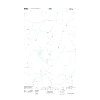
2013 Map of Augustine Lake
USGS Topo · Published 2013About this map
The East Fork Chippewa River meanders through the southern reaches of this Wisconsin landscape, serving as a primary hydrological feature in a region defined by its dense network of creeks and isolated lakes. Augustine Lake and the smaller Cammerer Lake are central landmarks, connected by the winding course of Augustine Cr. The area is interlaced with a series of forest and camp roads, such as Co Forest Road 6 and Bunte Shack Rd, which suggest a terrain utilized for timber management and seasonal recreation. This 2013 survey illustrates a largely uninhabited wilderness where water and wood are the dominant features, from the northern flow of Mineral Cr to the eastern edge of Duck Lake. Local landmarks like Lafeber Rd and Colby Rd provide reference points for navigating this backcountry terrain.
Find a feature on this map
27 named features on this map. Tap any name to fly to it.
Don’t see what you’re looking for? This feature index may not catch every label — zoom into the map to look around manually.
Map Details
Editions of this 2013 Augustine Lake Map
This is the sole edition of this map. No revisions or reprints were ever made.
Other maps of this area

1940 · Butternut
USGS Topo · 1:48,000

1940 · Upson
USGS Topo · 1:48,000

1942 · Glidden
USGS Topo · 1:48,000

1942 · Mellen
USGS Topo · 1:48,000

1943 · Upson
USGS Topo · 1:48,000

1945 · Glidden
USGS Topo · 1:48,000

1945 · Mellen
USGS Topo · 1:48,000

1947 · Butternut
USGS Topo · 1:48,000

1950 · Butternut
USGS Topo · 1:48,000

1953 · Ashland
USGS Topo · 1:250,000