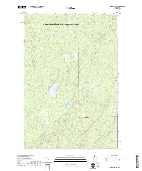
2022 Map of Augustine Lake
USGS Topo · Published 2022About this map
The East Fork Chippewa River winds through this northern Wisconsin landscape, marking a terrain defined by wetlands and dense forest roads along the border of Iron and Ashland counties. Central to this area is Augustine Lake, flanked by smaller water bodies including Cammerer Lake and Duck Lake. The intricate network of logging and fire roads, such as Masterson Fire Ln and Bunte Shack Rd, reveals a region managed for timber and conservation. A series of creeks, including Augustine Creek, Magee Cr, and Silver Cr, drain the glacial topography, illustrating the complex hydrology of the Chequamegon-Nicolet National Forest vicinity during the early twenty-first century. This study provides a precise look at the drainage patterns and access routes used by foresters and local sportsmen.
Find a feature on this map
45 named features on this map. Tap any name to fly to it.
Don’t see what you’re looking for? This feature index may not catch every label — zoom into the map to look around manually.
Map Details
Editions of this 2022 Augustine Lake Map
This is the sole edition of this map. No revisions or reprints were ever made.
Other maps of this area

1940 · Butternut
USGS Topo · 1:48,000

1940 · Upson
USGS Topo · 1:48,000

1942 · Glidden
USGS Topo · 1:48,000

1942 · Mellen
USGS Topo · 1:48,000

1943 · Upson
USGS Topo · 1:48,000

1945 · Glidden
USGS Topo · 1:48,000

1945 · Mellen
USGS Topo · 1:48,000

1947 · Butternut
USGS Topo · 1:48,000

1950 · Butternut
USGS Topo · 1:48,000

1953 · Ashland
USGS Topo · 1:250,000