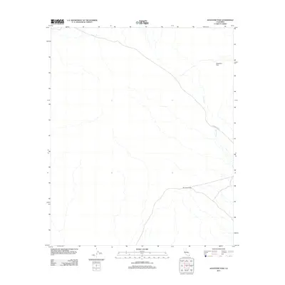
2012 Map of Augustine Pass
USGS Topo · Published 2012About this map
Augustine Pass and Surveyors Pass define this high-desert landscape in Imperial County, marking key points of transit through the arid terrain. The map centers on the historic route of The Bradshaw Trl, a vital 19th-century overland trail used by miners and express riders traveling toward the Colorado River. This 2012 survey documents the enduring physical path of the trail as it winds through the desert floor, crossing the seasonal drainage of the Arroyo Seco. The area is characterized by vast open spaces and ephemeral watercourses, where the sparse network of trails and passes represents the primary record of human movement across the harsh California interior.
Find a feature on this map
4 named features on this map. Tap any name to fly to it.
Don’t see what you’re looking for? This feature index may not catch every label — zoom into the map to look around manually.
Map Details
Editions of this 2012 Augustine Pass Map
This is the sole edition of this map. No revisions or reprints were ever made.
Other maps of this area

1940 · Iris Pass
USGS Topo · 1:62,500

1944 · Chuckwalla Mountains
USGS Topo · 1:62,500

1945 · Iris Pass
USGS Topo · 1:62,500

1952 · Sidewinder Well
USGS Topo · 1:62,500

1953 · Chuckwalla Spring
USGS Topo · 1:62,500

1954 · Salton Sea
USGS Topo · 1:250,000

1955 · Salton Sea
USGS Topo · 1:250,000
1956 · Iris Wash
USGS Topo · 1:24,000

1959 · Salton Sea
USGS Topo · 1:250,000

1963 · Salton Sea
USGS Topo · 1:250,000