
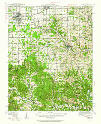
1942 Map of Aurora
USGS Topo · Published 1961About this map
Aurora and Marionville stand as the primary population centers along the northern edge of this 1940s survey, defined by the convergence of the St Louis-San Francisco and Missouri Pacific railroads. The landscape transitions from the open agricultural expanse of Buck Prairie into the deeply dissected terrain of the Ozark Plateau, where Crane Creek and Flat Creek carve narrow valleys. This transition is marked by a dense network of early rural institutions, including dozens of neighborhood schools like White Oak Sch and Mars Hill Sch, and remote churches such as Shiloh Ch.
Find a feature on this map
88 named features on this map. Tap any name to fly to it.
Don’t see what you’re looking for? This feature index may not catch every label — zoom into the map to look around manually.
Map Details
Editions of this 1942 Aurora Map
2 editions found
Other maps of this area

1884 · Springfield
USGS Topo · 1:125,000

1886 · Greenfield
USGS Topo · 1:125,000

1886 · Springfield
USGS Topo · 1:125,000

1888 · Greenfield
USGS Topo · 1:125,000

1907 · Forsyth
USGS Topo · 1:125,000

1919 · Halltown
USGS Topo · 1:62,500

1921 · Stotts City
USGS Topo · 1:62,500

1927 · Shell Knob
USGS Topo · 1:62,500

1937 · Cassville
USGS Topo · 1:48,000

1943 · Monett
USGS Topo · 1:62,500