
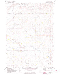
1964 Map of Aurora
USGS Topo · Published 1965About this map
Agricultural life in eastern South Dakota is defined by the section lines and small rail-centered settlements documented in this mid-1960s survey. The town of Aurora serves as a central hub, situated where the Chicago and North Western railroad cuts across the landscape. Further north, the village of Bushnell sits along the Chicago Rock Island and Pacific line, illustrating the importance of rail transport for moving grain and goods from the surrounding townships of Afton, Sherman, and Aurora.
Find a feature on this map
19 named features on this map. Tap any name to fly to it.
Don’t see what you’re looking for? This feature index may not catch every label — zoom into the map to look around manually.
Map Details
Editions of this 1964 Aurora Map
This is the sole edition of this map. No revisions or reprints were ever made.
Other maps of this area

1953 · Watertown
USGS Topo · 1:250,000

1958 · Watertown
USGS Topo · 1:250,000

1964 · Brookings
USGS Topo · 1:24,000

1964 · Medary
USGS Topo · 1:24,000

1964 · Flandreau NW
USGS Topo · 1:24,000

1968 · Brookings NE
USGS Topo · 1:24,000

1970 · White NE
USGS Topo · 1:24,000

1970 · White
USGS Topo · 1:24,000

1972 · Flandreau NE
USGS Topo · 1:24,000
1972 · White SE
USGS Topo · 1:24,000