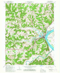
1966 Map of Aurora
USGS Topo · Published 1967About this map
Ohio River commerce and the Baltimore and Ohio railroad define this river valley landscape in Dearborn County. The city of Aurora serves as the primary hub, with its industrial footprint including a Pumping Station and nearby Cochran. The map illustrates a dense network of ridges and hollows that shaped local development, such as Possum Ridge and Thuermer Hollow.
Find a feature on this map
54 named features on this map. Tap any name to fly to it.
Don’t see what you’re looking for? This feature index may not catch every label — zoom into the map to look around manually.
Map Details
Editions of this 1966 Aurora Map
This is the sole edition of this map. No revisions or reprints were ever made.
Other maps of this area

1915 · Lawrenceburg
USGS Topo · 1:48,000

1928 · Lawrenceburg
USGS Topo · 1:62,500

1932 · Lawrenceburg
USGS Topo · 1:62,500

1943 · Aberdeen
USGS Topo · 1:24,000

1943 · Aurora
USGS Topo · 1:24,000

1943 · Rising Sun
USGS Topo · 1:24,000

1943 · Hooven
USGS Topo · 1:24,000

1943 · Guilford
USGS Topo · 1:24,000

1943 · Lawrenceburg
USGS Topo · 1:24,000

1951 · Rising Sun
USGS Topo · 1:24,000