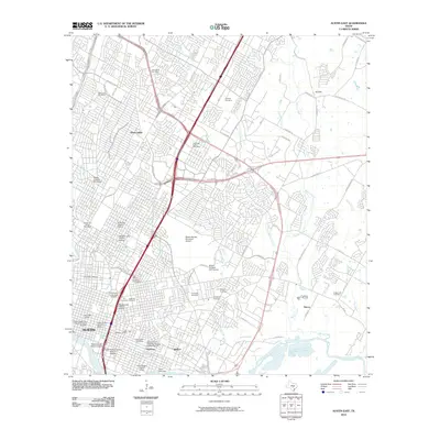
2010 Map of Austin East
USGS Topo · Published 2010About this map
The University of Texas and the core of the state capital dominate the western edge of this survey, revealing a landscape where institutional history meets mid-century suburban expansion. The capital’s legacy is preserved in several landmark areas, including the Sixth Street Historic District, the Rainey Street Historic District, and the State Cemetery of Texas. To the east, the vast footprint of the Robert Mueller Municipal Airport and the Morris Williams Golf Course define large tracts of open land amid the growing residential grid.
Find a feature on this map
82 named features on this map. Tap any name to fly to it.
Don’t see what you’re looking for? This feature index may not catch every label — zoom into the map to look around manually.
Map Details
Editions of this 2010 Austin East Map
This is the sole edition of this map. No revisions or reprints were ever made.
Other maps of this area

1896 · Austin
USGS Topo · 1:125,000

1897 · Austin
USGS Topo · 1:125,000

1910 · Austin
USGS Topo · 1:125,000

1932 · Mt. Bonnell
USGS Topo · 1:62,500

1954 · Austin East
USGS Topo · 1:24,000

1954 · Austin West
USGS Topo · 1:24,000

1954 · Austin
USGS Topo · 1:250,000

1955 · Montopolis
USGS Topo · 1:24,000

1955 · Oak Hill
USGS Topo · 1:24,000

1955 · Montopolis
USGS Topo · 1:62,500