
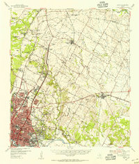
1955 Map of Oak Hill
USGS Topo · Published 1956About this map
Barton Creek and Williamson Creek carve through this mid-1950s landscape southwest of Austin, documenting a period of transition before suburban density fully arrived. The Missouri Pacific railroad corridor serves as a spine for early industrial and educational landmarks, including St Edwards University and the Extract Plant near the southern bend of Onion Creek. Evidence of local social life and community hubs is scattered throughout, from the Oak Hill Downs racetrack and the Austin Speedway to the Onion Creek Lodge No 220.
Find a feature on this map
52 named features on this map. Tap any name to fly to it.
Don’t see what you’re looking for? This feature index may not catch every label — zoom into the map to look around manually.
Map Details
Editions of this 1955 Oak Hill Map
This is the sole edition of this map. No revisions or reprints were ever made.
Other maps of this area

1896 · Austin
USGS Topo · 1:125,000

1897 · Austin
USGS Topo · 1:125,000

1910 · Austin
USGS Topo · 1:125,000

1932 · Mt. Bonnell
USGS Topo · 1:62,500

1954 · Austin East
USGS Topo · 1:24,000

1954 · Austin West
USGS Topo · 1:24,000

1954 · Austin
USGS Topo · 1:250,000

1955 · Montopolis
USGS Topo · 1:24,000

1955 · Montopolis
USGS Topo · 1:62,500
1955 · Austin
USGS Topo · 1:62,500