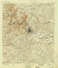
1955 Map of Austin
USGS Topo · Published 1956About this map
Austin and its northern surroundings during the mid-1950s reveal a landscape transitioning from rural farmsteads to suburban expansion. The city core is anchored by institutional landmarks such as St Marys Academy and the Texas Department of Public Safety, while the outskirts are dotted with specialized facilities like the Travis County Tuberculosis Sanitarium and the Austin State School Farm Colony. Further north, smaller communities such as McNeil, Pflugerville, and the Swedish-settled area of New Sweden maintain their rural identity, connected by the Missouri Pacific RR and Southern Pacific RR.
Find a feature on this map
85 named features on this map. Tap any name to fly to it.
Don’t see what you’re looking for? This feature index may not catch every label — zoom into the map to look around manually.
Map Details
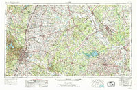
Editions of this 1955 Austin Map
This is the sole edition of this map. No revisions or reprints were ever made.
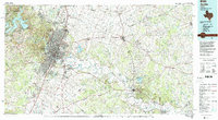
Historical Maps of Austin Through Time
6 maps found