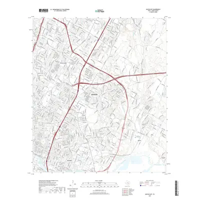
2019 Map of Austin East
USGS Topo · Published 2019About this map
The eastern reaches of Austin are characterized by a dense concentration of significant burial grounds and urban waterways during this 2019 survey. Extensive tracts are dedicated to Oakwood Cem, Evergreen Cem, and the Texas State Cem, providing a detailed record for genealogists and local historians. The landscape is shaped by the curve of the Colorado River and Lady Bird Lake, where the Lady Bird Lake Trail follows the shoreline. Neighborhoods such as Abercrombie, Pershing, and Smoot are shown amidst a complex transportation network including Ed Bluestein Blvd and E Koenig Ln. Smaller water features like Waller Creek, Boggy Creek, and Tannehill Branch drain the city toward the river, while the Southern Walnut Creek Trail offers a modern recreational corridor through the eastern terrain.
Find a feature on this map
30 named features on this map. Tap any name to fly to it.
Don’t see what you’re looking for? This feature index may not catch every label — zoom into the map to look around manually.
Map Details
Editions of this 2019 Austin East Map
This is the sole edition of this map. No revisions or reprints were ever made.
Other maps of this area

1896 · Austin
USGS Topo · 1:125,000

1897 · Austin
USGS Topo · 1:125,000

1910 · Austin
USGS Topo · 1:125,000

1932 · Mt. Bonnell
USGS Topo · 1:62,500

1954 · Austin East
USGS Topo · 1:24,000

1954 · Austin West
USGS Topo · 1:24,000

1954 · Austin
USGS Topo · 1:250,000

1955 · Montopolis
USGS Topo · 1:24,000

1955 · Oak Hill
USGS Topo · 1:24,000

1955 · Montopolis
USGS Topo · 1:62,500