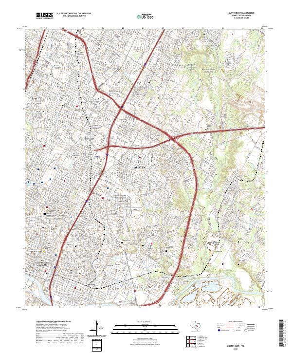
2022 Map of Austin East
USGS Topo · Published 2022About this map
The Colorado River defines the southern reach of this East Austin landscape, where the urban grid of Austin meets established residential pockets like Pershing, Smoot, and Abercrombie. This 2022 survey documents a dense concentration of academic and civic institutions, ranging from The University of Texas at Austin and Huston Tillotson University to specialized centers like the Academy of Oriental Medicine. The map is particularly valuable for genealogical research, as it identifies numerous burial grounds across the city, including the expansive Oakwood Cem, the historically significant Evergreen Cem, and the smaller Fiskville Cem.
Find a feature on this map
59 named features on this map. Tap any name to fly to it.
Don’t see what you’re looking for? This feature index may not catch every label — zoom into the map to look around manually.
Map Details
Editions of this 2022 Austin East Map
This is the sole edition of this map. No revisions or reprints were ever made.
Other maps of this area

1896 · Austin
USGS Topo · 1:125,000

1897 · Austin
USGS Topo · 1:125,000

1910 · Austin
USGS Topo · 1:125,000

1932 · Mt. Bonnell
USGS Topo · 1:62,500

1954 · Austin East
USGS Topo · 1:24,000

1954 · Austin West
USGS Topo · 1:24,000

1954 · Austin
USGS Topo · 1:250,000

1955 · Montopolis
USGS Topo · 1:24,000

1955 · Oak Hill
USGS Topo · 1:24,000

1955 · Montopolis
USGS Topo · 1:62,500