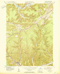
1950 Map of Austin
USGS Topo · Published 1950About this map
The Allegheny River cuts through the northern reaches of this Potter County landscape, passing through the settlement of Olmstead and near the Pump Station Hol. To the south, the borough of Austin occupies the valley of Freeman Run, a focal point for local industry and transport following the 1945 aerial photography used for this survey. The terrain is defined by an intricate network of deep hollows and ridges, such as Mina Hill and Cherry Flat, many of which bear the names of early families and local landmarks.
Find a feature on this map
70 named features on this map. Tap any name to fly to it.
Don’t see what you’re looking for? This feature index may not catch every label — zoom into the map to look around manually.
Map Details
Editions of this 1950 Austin Map
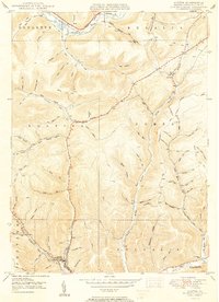
2 editions found
Other maps of this area

1932 · Genesee
USGS Topo · 1:62,500

1934 · Coudersport
USGS Topo · 1:48,000

1937 · Genesee
USGS Topo · 1:62,500

1938 · Coudersport
USGS Topo · 1:62,500

1947 · Conrad
USGS Topo · 1:62,500

1947 · Conrad
USGS Topo · 1:24,000

1947 · Ayers Hill
USGS Topo · 1:24,000

1948 · Emporium
USGS Topo · 1:62,500

1948 · Keating Summit
USGS Topo · 1:24,000

1948 · Emporium
USGS Topo · 1:24,000