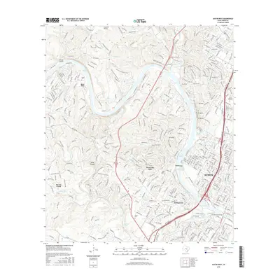
2016 Map of Austin West
USGS Topo · Published 2016About this map
Lake Austin winds through the limestone hills of the Colorado River valley, anchoring a landscape defined by suburban expansion and preserved natural landmarks. In the eastern portion of the map, the urban edge of Austin meets the high ground of the Jollyville Plateau and the iconic overlook at Mt Bonnell. The terrain is deeply dissected by drainages such as Barton Creek and Bee Creek, where the hydrology of the Edwards Aquifer emerges through numerous named outlets including Barton Springs, Eliza Spring, and Old Mill Spring. Residential communities like West Lake Hills, Rollingwood, and Lost Creek are mapped alongside local history markers such as the McNeil Cem and Tucker Cem. The presence of the Emma Long Motocross Park and the Lamar Boulevard Bridge over Lady Bird Lake reflects the area's transition into a modern recreational and transit hub.
Find a feature on this map
46 named features on this map. Tap any name to fly to it.
Don’t see what you’re looking for? This feature index may not catch every label — zoom into the map to look around manually.
Map Details
Editions of this 2016 Austin West Map
This is the sole edition of this map. No revisions or reprints were ever made.
Other maps of this area

1896 · Austin
USGS Topo · 1:125,000

1897 · Austin
USGS Topo · 1:125,000

1910 · Austin
USGS Topo · 1:125,000

1930 · Austin-2
USGS Topo · 1:48,000

1932 · Mt. Bonnell
USGS Topo · 1:62,500

1954 · Austin East
USGS Topo · 1:24,000

1954 · Austin West
USGS Topo · 1:24,000

1954 · Austin
USGS Topo · 1:250,000

1955 · Montopolis
USGS Topo · 1:24,000

1955 · Oak Hill
USGS Topo · 1:24,000